

Coastal Skipper and Yachtmaster Quiz
Electronic navigation: 7 Questions
The Electronic navigation Questions
-
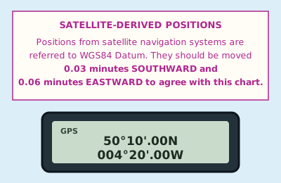 Your GPS is working in WGS84 and the chart carries this note. What position do you plot?
 -
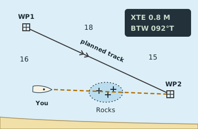 The tide has set you well off your planned track, and the GPS now offers a new bearing straight to the waypoint (the dashed line). What is wrong with simply following it?
 -
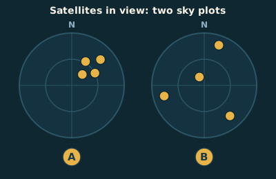 Which of these satellite patterns gives the more accurate position, and how does the receiver show it?
 -
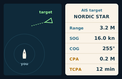 What do the CPA and TCPA figures for this AIS target tell you?
 -
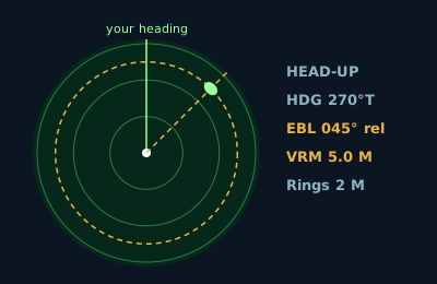 The radar is in head-up mode and you are steering 270°T. The electronic bearing line (EBL) through the target reads 045° relative. What is the true bearing of the target?
 -
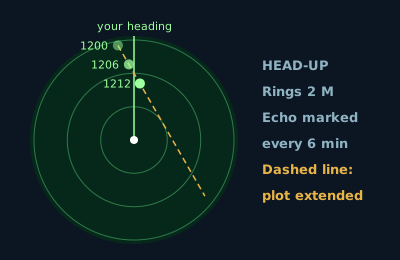 You have marked this target three times and extended the line through the marks. If neither of you alters, about how close will she pass?
 -
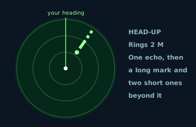 The echo of a buoy on your radar has a trail beyond it: one long mark and two short ones, pointing away from you. What is it?